
Land Surveying Helps Property Owners Address Coastal Boundary Changes
Owning land along the coast brings many benefits such as open views, fresh air, and direct access to the water. However, it also comes with natural changes that do not affect properties further inland. The place where land meets water never stays exactly the same. Waves, tides, storms, and shifting currents slowly reshape the shoreline year after year. Over time, these changes can alter the actual size and legal limits of your property. Land surveying gives you precise measurements and clear records so you can understand these shifts, protect your rights, and plan your land use with confidence.
How Shoreline Movement Can Affect Long-Term Property Planning
Coastal areas are constantly changing through two main natural processes. Erosion happens when water pulls away soil, sand, and rock from the land. Accretion occurs when rivers and currents carry sediment and deposit it along the shore, adding new ground. Most of these changes happen slowly over many years, but strong storms or high tides can move large amounts of material in just a few days.
These shifts matter a great deal when you think about future plans. You may want to build a home, create a garden, or install outdoor spaces. If you rely only on old maps or memory, you might place structures too close to the water line or assume you own land that no longer exists. In other cases, new land may form, and you need to know if it falls under your legal ownership.
When you track how the shoreline moves, you make smarter decisions. You can choose safer building locations, adjust your design to fit available space, or take steps to protect the land you have. This awareness helps you avoid costly mistakes and keeps your plans realistic for years to come.
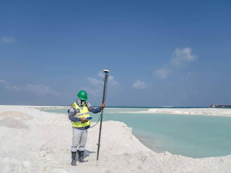
Documenting Waterfront Conditions Through Updated Land Surveying
A proper land survey creates an accurate picture of what your property looks like right now. Along the coast, this work goes far beyond marking simple boundary corners. It captures details that change often and matter greatly for legal and practical use. Updated land surveying provides a reliable snapshot that includes:
- Exact elevations measured from the water level to the highest points of the land
- Precise distances between official property markers and the current water edge
- Location of natural features such as rocks, sandbars, vegetation, and slopes
- Position of any man-made structures like walls, docks, walkways, or drainage systems
- Comparison data against older records to show how much the shoreline has shifted over time
Old surveys become outdated quickly. A map made ten or fifteen years ago will not reflect changes caused by storms, seasonal tides, or gradual erosion. A new survey fixes this gap. It creates a clear baseline you can use to compare future measurements and spot trends before they turn into serious problems.
Understanding the Relationship Between Natural Changes and Property Ownership
Many people assume that property lines stay fixed forever once they are drawn. This idea does not always hold true along the coast. Local laws treat boundaries differently depending on how and why the shoreline moves. If changes happen slowly and naturally over time, the legal boundary often moves along with the water line. If land shifts suddenly or because of human activity, the original boundary line usually remains in place.
These rules can lead to confusion. Neighbors may disagree about where one lot ends and another begins. Local agencies may ask questions about how much land counts as private property versus public shoreline. Land surveying does not make legal decisions, but it provides the hard facts needed to answer these questions. It combines current measurements, historical maps, and official records to show exactly how the boundary has changed and why it sits where it does today.
Having this clear information removes guesswork. It helps you understand exactly what you own and what rights you hold, which prevents disputes and gives you peace of mind.
Supporting Permit Applications for Waterfront Improvements
Many coastal property owners want to add features that make their land more useful or enjoyable. Common projects include building a dock, installing a boat ramp, adding a retaining wall, or creating a path down to the water. Almost every local government requires a permit before starting work near the shoreline.
Officials review applications carefully to make sure projects do not harm the environment, block public access, or cross onto neighboring land. Land surveying provides the detailed data they need to approve your plans. It shows exactly where your project will sit, how far it stays from the water line, and how it fits around existing natural features.
When you include a recent survey with your application, you answer important questions before they are asked. This speeds up the review process and reduces delays caused by requests for extra information. It also helps you design improvements that follow safety rules and environmental guidelines.
Establishing a Reliable Record for Future Property Transactions
If you plan to sell, refinance, or pass your land to family members later, you will need clear proof of its current size and boundaries. Buyers, lenders, and title companies all want to know exactly what they are dealing with. They want to see how the shoreline has changed and whether those changes affect the value or use of the property.
A recent land survey creates a permanent, time-stamped record. It shows the property lines, elevations, and shoreline position at that specific moment. This document removes uncertainty and reduces arguments during negotiations. It also protects you from claims that may arise years later about where the boundary used to be.
Lawyers and real estate professionals rely on these records to confirm ownership details. Having accurate information ready makes the whole transaction smoother and faster. It gives everyone involved confidence that the land matches its description and legal status.
Frequently Asked Questions
Why do coastal property boundaries require periodic review?
Shorelines shift naturally over time. Water levels rise and fall, storms remove soil or deposit new sand, and currents reshape the coast. Regular reviews confirm that boundary lines still match current conditions. They also help you stay aware of changes that could affect your land rights, usable space, and future plans.
How often should waterfront properties be surveyed?
There is no single rule, but most experts recommend completing a new survey every five to ten years. You should also arrange for a survey after major storms, floods, or construction work that could alter the shoreline. Keeping records updated helps you spot changes early and plan ahead.
Can shoreline movement affect future development plans?
Yes. If the water moves closer to your land, you may have less space available for building or outdoor use. Local rules may also limit construction near shifting shorelines to reduce risk. Knowing how much movement has happened helps you choose safe and legal locations for any new structures.
What information does a coastal land survey typically document?
It records exact property lines, the current position of the water boundary, and elevation levels across the site. It also notes natural features such as slopes, rocks, and vegetation, plus any existing structures or improvements. All of this data creates a full and accurate picture of the property.
Why is survey documentation helpful during waterfront property transactions?
It gives buyers and lenders clear proof of what is included in the sale. It shows both past and current conditions, which reduces uncertainty about size, boundaries, and risks. It also helps resolve any questions about ownership so both parties can move forward with confidence.