
Topographic Survey Data Is Shaping Site Plans on Steep and Uneven Terrain
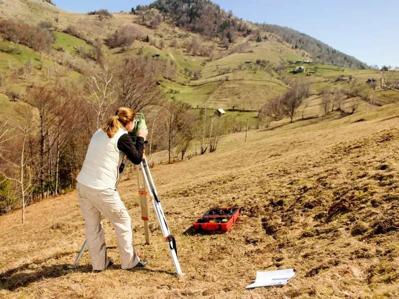
Not all land is flat and easy to work with. Many properties have hills, slopes, and uneven ground that make planning difficult. A topographic survey maps every rise and fall across a site. It shows exactly how high or low each point is, and how the land changes from one area to the next. This clear picture helps teams design projects that fit naturally with the land instead of fighting against it.
Topographic Survey Information Helps Identify Buildable Areas Across Challenging Elevations
On steep or rolling ground, only certain spots work well for construction. Some areas may be too high, too low, or too sloped to support buildings or parking spaces. Without knowing these details, planners might choose locations that require heavy work to level or prepare. This can add time and cost to any project.
Topographic survey data shows these differences clearly. It marks out zones where the ground is stable enough and the slope is gentle enough to build. It also highlights areas that are better left as they are. With this information, teams can focus their plans on the most practical parts of the property. They avoid moving large amounts of earth or reshaping the land more than necessary.
Natural Landform Mapping Is Influencing Early Project Layout Decisions
The shape of the land itself acts as a guide for design. Ridges, valleys, and flat benches all have their own characteristics. These features can help decide where to place roads, houses, or other structures. Building along the natural flow of the land often creates a better result than trying to force a design onto a site.
When planners have a full map of these landforms, they can arrange every part of the project to follow the existing shape. They can place buildings on more level sections and use slopes for open spaces or paths. This approach keeps the site looking natural and reduces the need for major changes. It also makes the final layout feel like it belongs in the landscape.
Topographic Survey Reviews Are Supporting More Efficient Access Planning
Getting in and around a property becomes harder when the ground rises and falls. Driveways, private roads, and walkways must follow a safe and workable angle. If the slope is too steep, vehicles or people will struggle to use them. If the path is too long or winding, it adds distance and cost.
A topographic survey reveals exactly how elevation changes across possible routes. It helps planners find the most direct and practical way to move from one part of the site to another. They can choose paths that follow gentler grades and avoid the steepest sections. This early understanding means access routes work well from day one and require less work to build and maintain.
Some of the key details used in this process include:
- Changes in height along potential road or driveway lines
- Distance between high and low points
- Direction and steepness of slopes
- Connections between different levels of the property
Having these facts makes it easier to plan routes that fit the land perfectly.
Terrain Complexity Is Increasing the Need for Detailed Surface Modeling
Simple sketches or basic maps do not show the full picture of uneven ground. It can be hard to imagine how a site looks or how different parts connect without seeing it clearly. This is where detailed surface models come in. These models are built from the measurements taken during a topographic survey.
They create a clear visual representation of the entire property. Anyone working on the project can see how the land slopes, where it rises, and where it falls. This view helps everyone understand the site in the same way before any plans are set. It turns numbers and measurements into a clear image that guides every step of the early design work.
Topographic Survey Data Helps Teams Compare Multiple Site Configuration Options
When working with difficult terrain, there is rarely only one way to arrange a project. Planners often think of several different layouts before choosing the best one. Each option may place buildings, roads, and open spaces in different spots.
Topographic data lets teams test each idea against the real conditions of the land. They can see which layout fits best, which requires the least adjustment, and which offers the most useful space. Comparing these options early helps pick the approach that works best for both the project goals and the natural shape of the site. This flexibility leads to smarter decisions and a stronger final plan.
Frequently Asked Questions
What types of terrain are commonly evaluated through a topographic survey?
Topographic surveys are commonly used on properties with hills, valleys, slopes, ridges, uneven ground, and significant elevation changes. They provide the details needed to understand how the land is shaped.
Can a topographic survey help with site layout planning?
Yes. Topographic survey data provides detailed elevation information that helps teams evaluate potential site configurations. It shows where features can be placed without causing problems or extra work.
Why is terrain modeling important during project planning?
Terrain models help visualize existing site conditions and allow project teams to study how different layouts may interact with the land. They make it easier to see challenges and opportunities before moving forward.
Who typically uses topographic survey information?
Developers, architects, planners, engineers, property owners, and design consultants often rely on topographic survey data. It serves as the base for all decisions related to the physical arrangement of the site.
When is a topographic survey usually performed during a project?
A topographic survey is often completed early in the planning process to provide accurate information before design decisions are made. It sets the stage for all work that follows.