
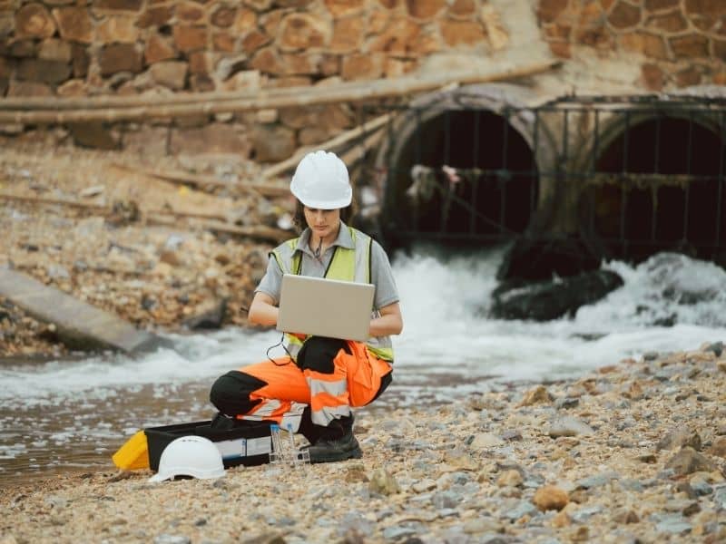
Construction Survey Accuracy Supports Stormwater Infrastructure Improvements
Stormwater systems work quietly beneath and across developed areas to protect land, buildings, and roads from flooding. These networks move rainwater away from streets, homes, and commercial sites toward safe outlets or storage areas. For them to work as planned, every part must sit at exactly the right height and angle. Even a small error in placement can cause water to pool, flow backward, or overload parts of the system. Construction survey accuracy provides the precise measurements needed to build these facilities correctly and keep them working reliably for years.
Why Stormwater Infrastructure Depends on Precise Vertical Measurements
Water flows only one way, from higher ground to lower ground. This simple rule guides every part of stormwater design. Engineers calculate exact elevations so pipes, channels, and basins create a steady downhill path. If a section is built too high, water will stop moving and collect in low spots. If it sits too low, it may take on extra flow that causes pressure or damage.
Construction survey services set these critical heights before any digging or installation begins. They mark reference points that show exactly where each structure should sit. These measurements are far more exact than standard maps or visual estimates. They make sure the slope stays consistent from one end of the system to the other. When vertical positioning is correct, water follows the planned route without interruption.
This level of care also prevents larger problems later. Systems built with accurate elevations need fewer repairs and operate with less strain over time.
Supporting the Installation of Retention and Detention Facilities
Many projects include special areas to hold rainwater temporarily. Retention ponds keep water until it slowly soaks into the ground or evaporates. Detention basins release water at a controlled rate to avoid overwhelming nearby streams or pipes. Underground storage tanks serve the same purpose in places where open space is limited.
Each of these features has strict design rules for depth, width, and slope. Construction survey services guide crews through every stage of building. They mark the limits of the excavation, confirm the depth of the bottom, and check the height of the surrounding banks. They make sure the finished shape matches the planned size and volume.
During construction, they also verify that the floor of the basin sits at the right elevation. This ensures the facility can hold the required amount of water and release it at the proper speed. Without these checks, a pond or tank may end up too shallow or uneven, which reduces its ability to work when heavy rain falls.
Maintaining Proper Connections Between Multiple Drainage Components
A complete stormwater network links many different parts. It includes street inlets, underground pipes, manholes, culverts, and open channels. Every piece must connect smoothly to the next. If one inlet sits higher or lower than the pipe leading away from it, water cannot flow freely. If a manhole is out of alignment, it can create blockages or pressure points.
Construction survey accuracy creates a continuous line of reference across the entire site. It sets the exact location and height for every connection point. This lets crews install each part knowing it will line up with the section before and after it. Even when work happens in different areas or at different times, all teams follow the same set of measurements.
This consistency removes gaps or mismatches in the system. Water moves through the network without stopping or backing up, and each component carries only the load it was designed to handle.
Helping Contractors Meet Design Tolerances During Construction
Engineers set small limits for how much a structure can differ from the plan. These limits are called tolerances. For stormwater work, the range is often very narrow. A difference of just a few centimeters can change how well the system functions.
Construction survey services check progress at key steps. They measure the depth of trenches before pipes go in, confirm pipe slopes during installation, and verify the final elevation once parts are in place. If something is off, they flag it immediately so crews can adjust before covering the work or moving ahead.
These checks help projects stay within allowed limits. They reduce the chance of tearing out finished work to fix errors. Meeting design tolerances also means the system will perform as tested and approved by local authorities.
Supporting Long-Term Performance Through Accurate Field Layout
The quality of work done during construction sets the standard for how well the system will serve the community for decades. When layout measurements are correct from the start, the infrastructure faces fewer problems after it opens. It avoids common issues such as standing water, sediment buildup, or uneven flow.
Accurate survey records also become useful later. If repairs or expansions are needed years down the road, crews can use the original data to understand how the system was built. They can match new work to existing elevations and connections easily.
Good layout work lowers long-term maintenance needs. It keeps the system running smoothly, reduces the risk of damage during storms, and protects the value of nearby properties.
Frequently Asked Questions
Why are vertical measurements important for stormwater infrastructure projects?
Water moves only from higher to lower ground. Exact elevations set the slope and direction of flow. Without correct vertical measurements, pipes and channels may not drain properly, leading to pooling, overflow, or damage to surrounding areas.
How do construction survey services support detention and retention system construction?
They mark the correct boundaries, depth, and slope for basins, ponds, and storage tanks. They confirm that the finished size and shape match design plans so the facility holds and releases water exactly as intended.
What types of stormwater structures require survey-guided installation?
All main parts of the system benefit from accurate measurements. This includes underground pipes, inlets, manholes, culverts, open channels, and storage facilities. Each needs precise placement to work together.
Why is alignment important within a stormwater drainage network?
Every section must connect smoothly to the next. Good alignment prevents gaps, bends, or mismatches that slow flow or cause blockages. It ensures water moves through the entire system without interruption.
How can construction survey accuracy influence long-term infrastructure performance?
Proper layout and measurements reduce early wear and prevent common problems like standing water or uneven pressure. Systems built with care require fewer repairs, last longer, and work reliably during heavy rain events.